Climate Intelligence App – Global exposure analysis and risk insights

Climate Intelligence App in brief
Maintain business continuity
Grow through improved insights
Multiple perils
Our climate risk scoring methodology
The Twinn climate risk intelligence platform is based on proprietary IP developed over 20 years. Our methodology combines high-resolution natural hazard data with cutting-edge machine learning, climate exposure analysis and risk scoring systems.
- Get climate risk scores based on 19 natural hazards – including floods (coastal, fluvial, pluvial), tropical storms, drought, wildfires, earthquakes, volcano activity and hail
- Understand climate exposure for individual sites – we can provide data and risk scores at any resolution, down to specific addresses and site locations worldwide
- Integrate risk intelligence into decision-making – get climate risk scores and data
- via flat files, APIs or our dynamic visualisation and monitoring platform, so you’re better able to assess, manage and mitigate risks for each asset

Assess your climate risks with Twinn
You may understand how your business impacts the climate. But do you understand how climate change impacts your processes and operations?
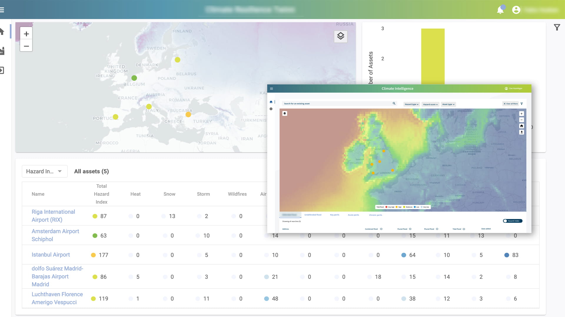
Twinn’s free Climate Risk Quick Scan gives you actionable insights on how natural hazards and severe weather affect your organisation’s physical assets worldwide, today and in the future.
How the Twinn climate risk intelligence platform works

Historic, real-time, and future climate risk intelligence
- Access risk intelligence based on 20 years of historic climate data
- Get real-time climate exposure and risk insights*
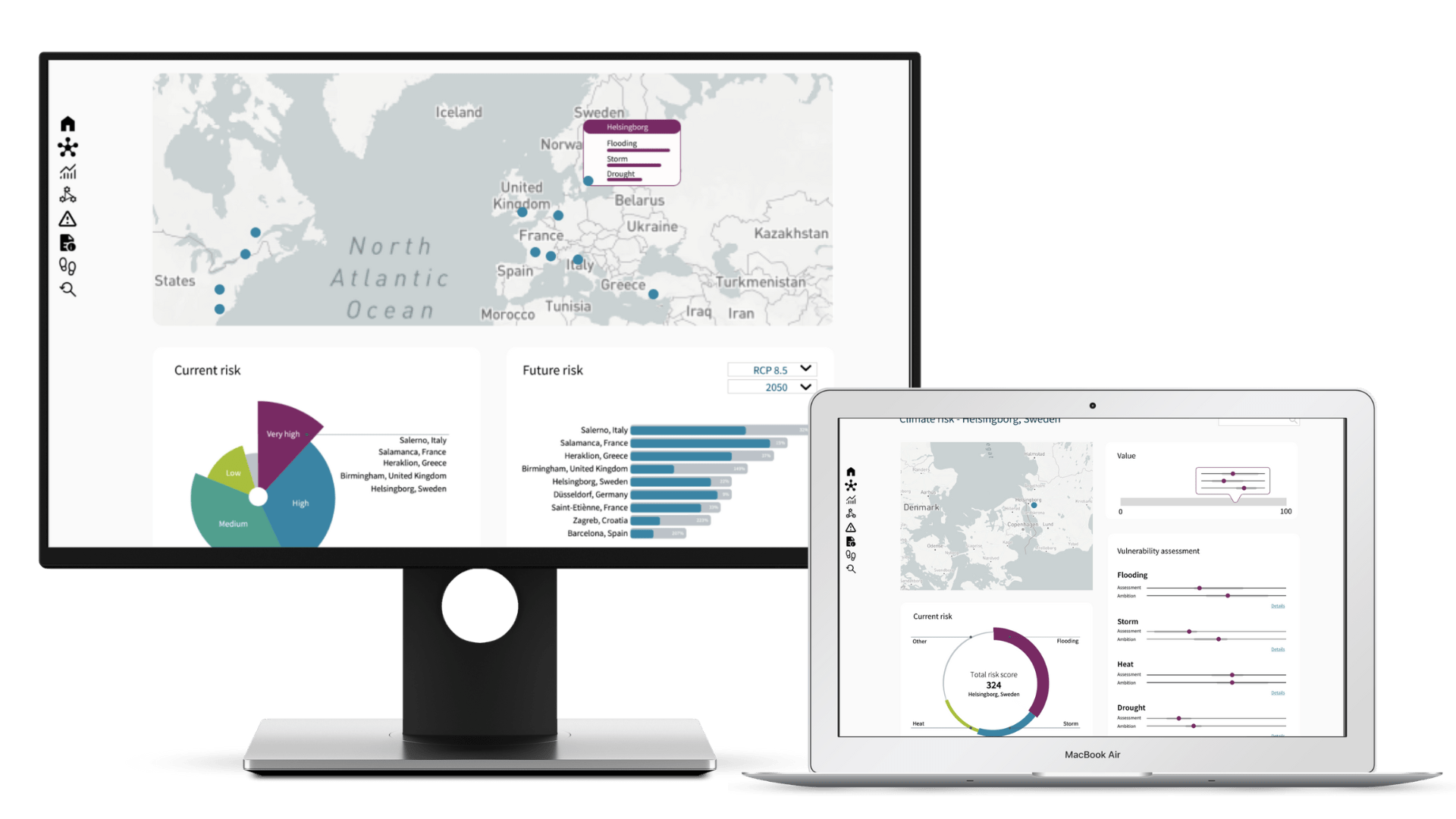
- See climate risk scores for various future climate scenarios based on RCP and SSP projections aligned with the latest IPCC findings
- Perform portfolio and supply chain analyses with ease
- Develop climate adaptation strategies and implement climate change-ready measures
* Depending on data availability and frequency of updates
24/7 risk intelligence through built-in alerting
- Stay up-to-date on how climate hazards may impact your business continuity, e.g. due to:
- Physical damage to your assets during a flood event
- Supply chain issues due to affected port disruptions following a storm event
- On-site employee safety due to an earthquake or wildfire
- Make informed decisions to safeguard your people and physical assets, protect operations and optimise your supply chains

Climate exposure and risk scores for infrastructure worldwide
- Transport – ports, airports, roads and railroads
- Real estate – commercial and residential buildings
- Industry – production facilities, processing plants and supply chain networks
- Energy – power plants, distribution networks, communication towers
- Water infrastructure – dams, reservoirs, networks and treatment plants
- Logistics and facilities – warehouses, storage hubs and data centres

At the click of a button, see climate hazards affecting your business, as well as your suppliers and even your customers – anywhere in the world.
Climate risk intelligence at your fingertips
