Anticipate disruption from natural hazards
Protect your operations and supply chains from the impacts of unexpected climate hazards.
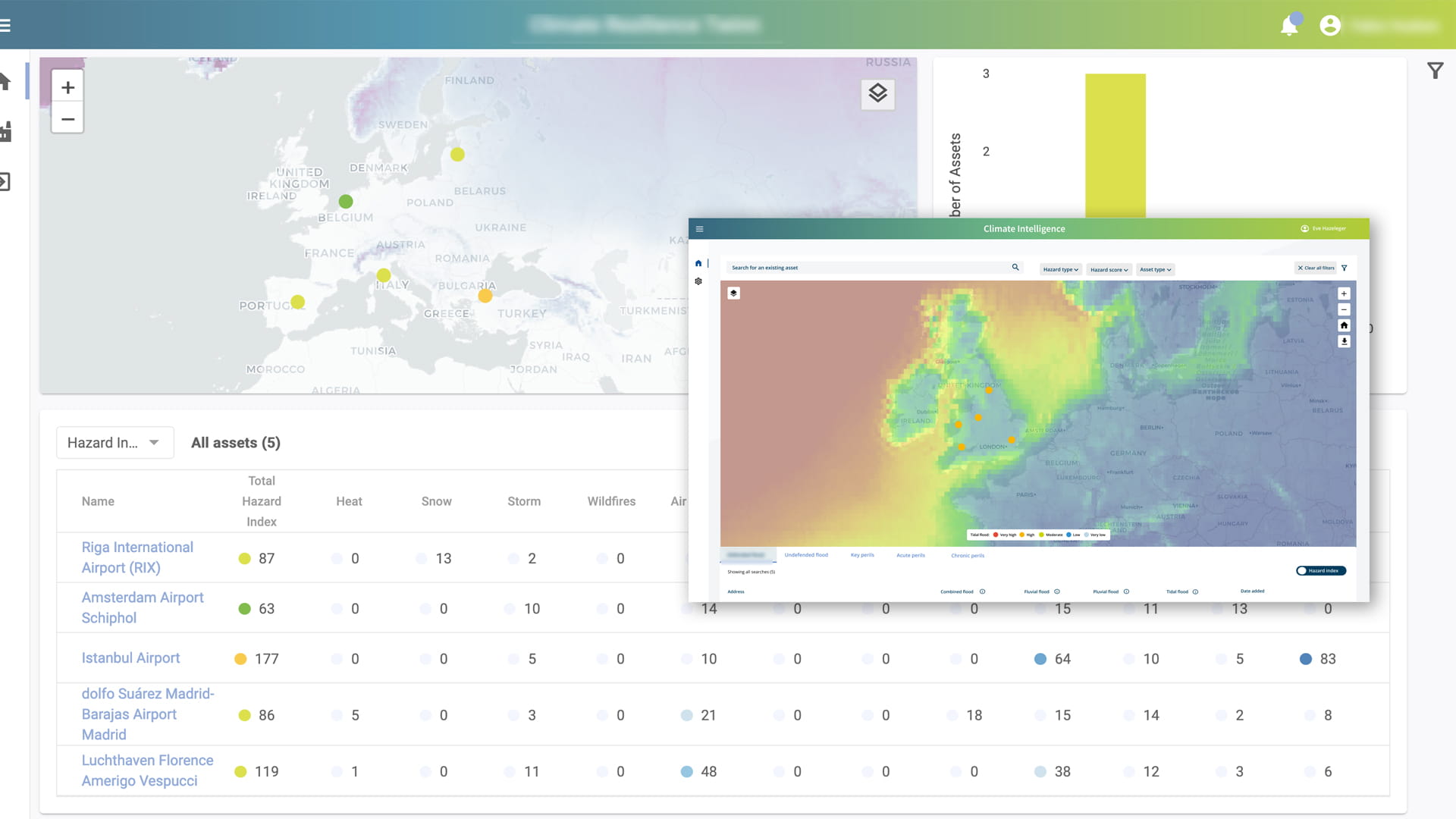
Climate Intelligence App in brief
The Twinn climate risk intelligence platform is based on proprietary IP developed over 20 years. Our methodology combines high-resolution natural hazard data with cutting-edge machine learning, climate exposure analysis and risk scoring systems.

You may understand how your business impacts the climate. But do you understand how climate change impacts your processes and operations?
Twinn’s free Climate Risk Quick Scan gives you actionable insights on how natural hazards and severe weather affect your organisation’s physical assets worldwide, today and in the future.
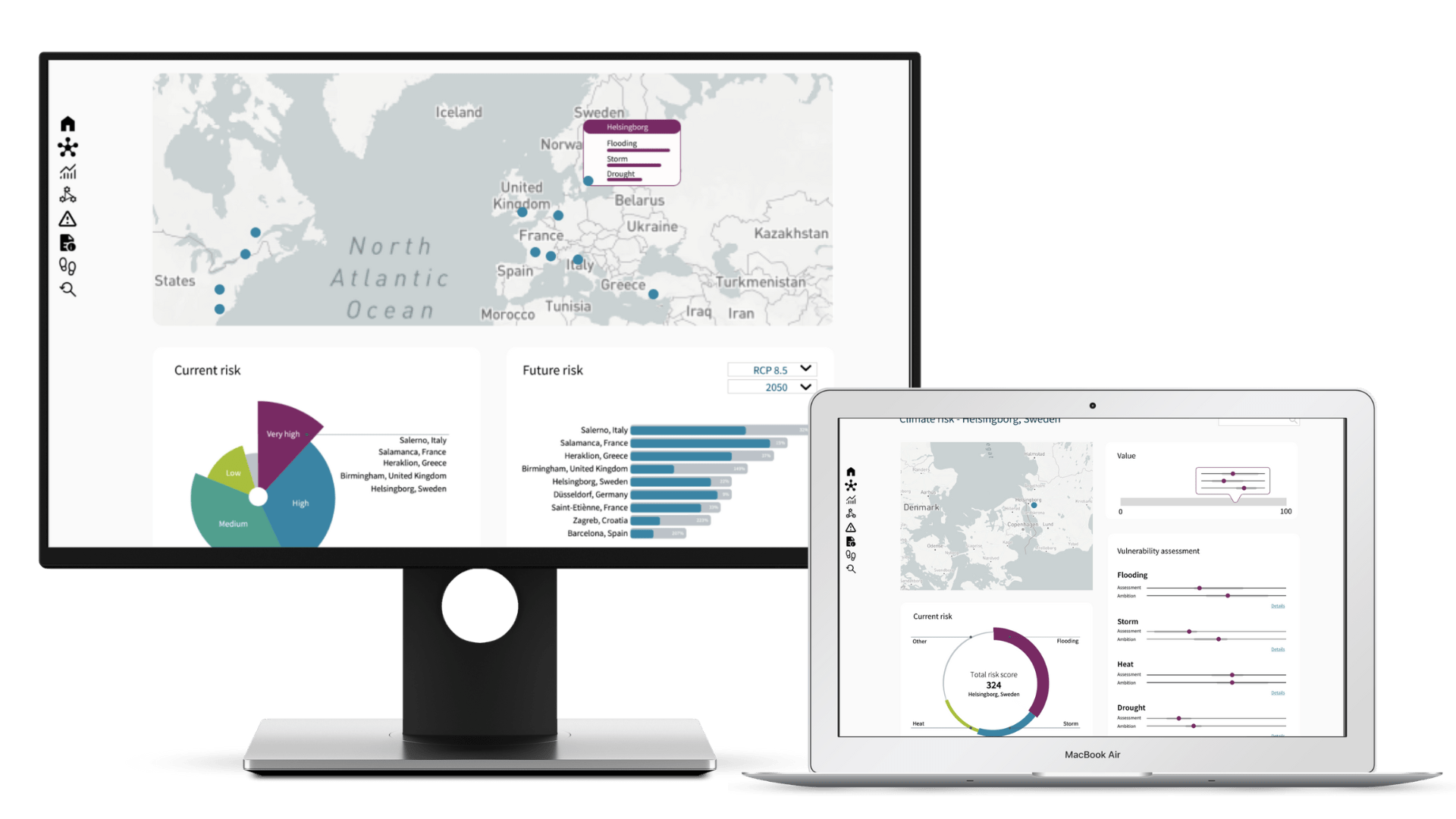


At the click of a button, see climate hazards affecting your business, as well as your suppliers and even your customers – anywhere in the world.
Climate risk intelligence at your fingertips