
Product support for every stage of your climate resilience journey
Our global risk consulting, resilience, and sustainability solutions help you navigate climate risk complexity in an efficient and compliant way. Our comprehensive range of resilience products and services is underpinned by our deep understanding of how weather affects processes, assets, and the built environment.
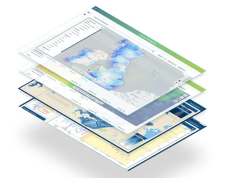
What gives Twinn's hazard data the edge?
Unlocking success: How we work with partners
Check the Reseller partners page every Friday to watch the latest video in our exclusive Reseller partner series. We'll add the latest video to the playlist each week. To watch the entire playlist for the series visit YouTube. Here's a sample!

At the click of a button, see climate hazards affecting your business, as well as your suppliers and even your customers – anywhere in the world.